Simple guide to Ukraine crisis in maps
Skip image galleryTap or click to go through the gallery
-
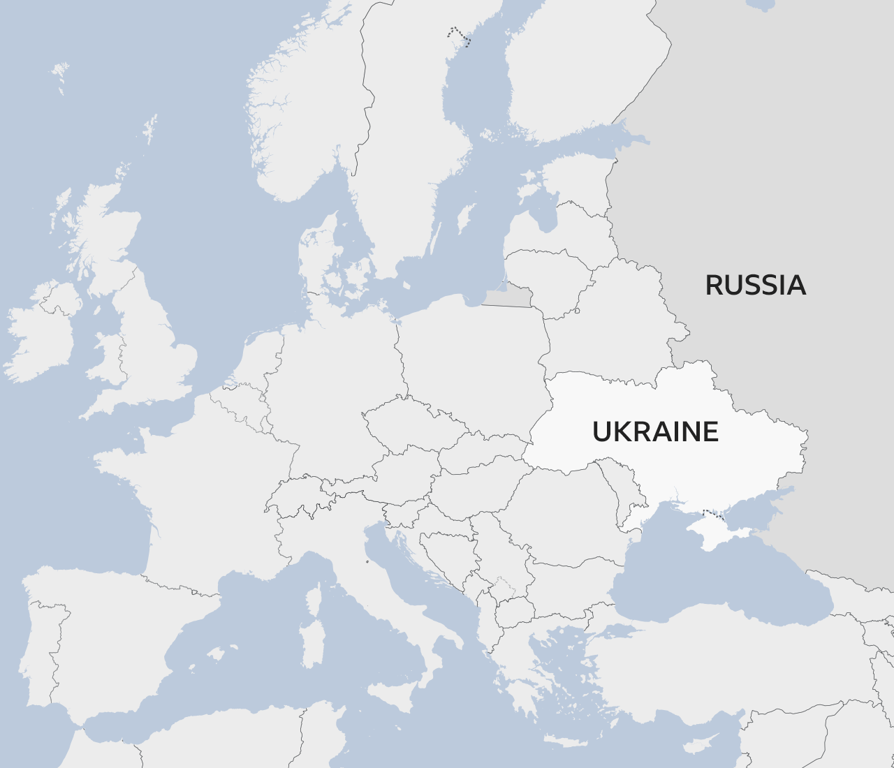 Image caption: Ukraine is in Eastern Europe and shares a border with Russia. It used to be part of the Soviet Union but became an independent country in 1991.
 -
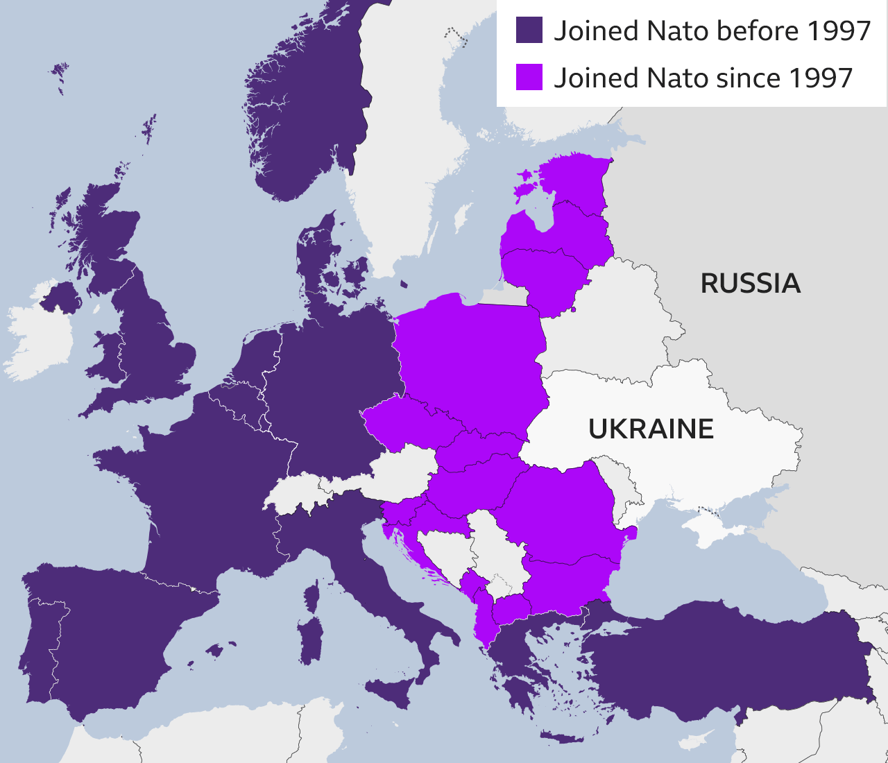 Image caption: It also borders several other countries that are members of Nato, a defensive military alliance formed after World War Two.
 -
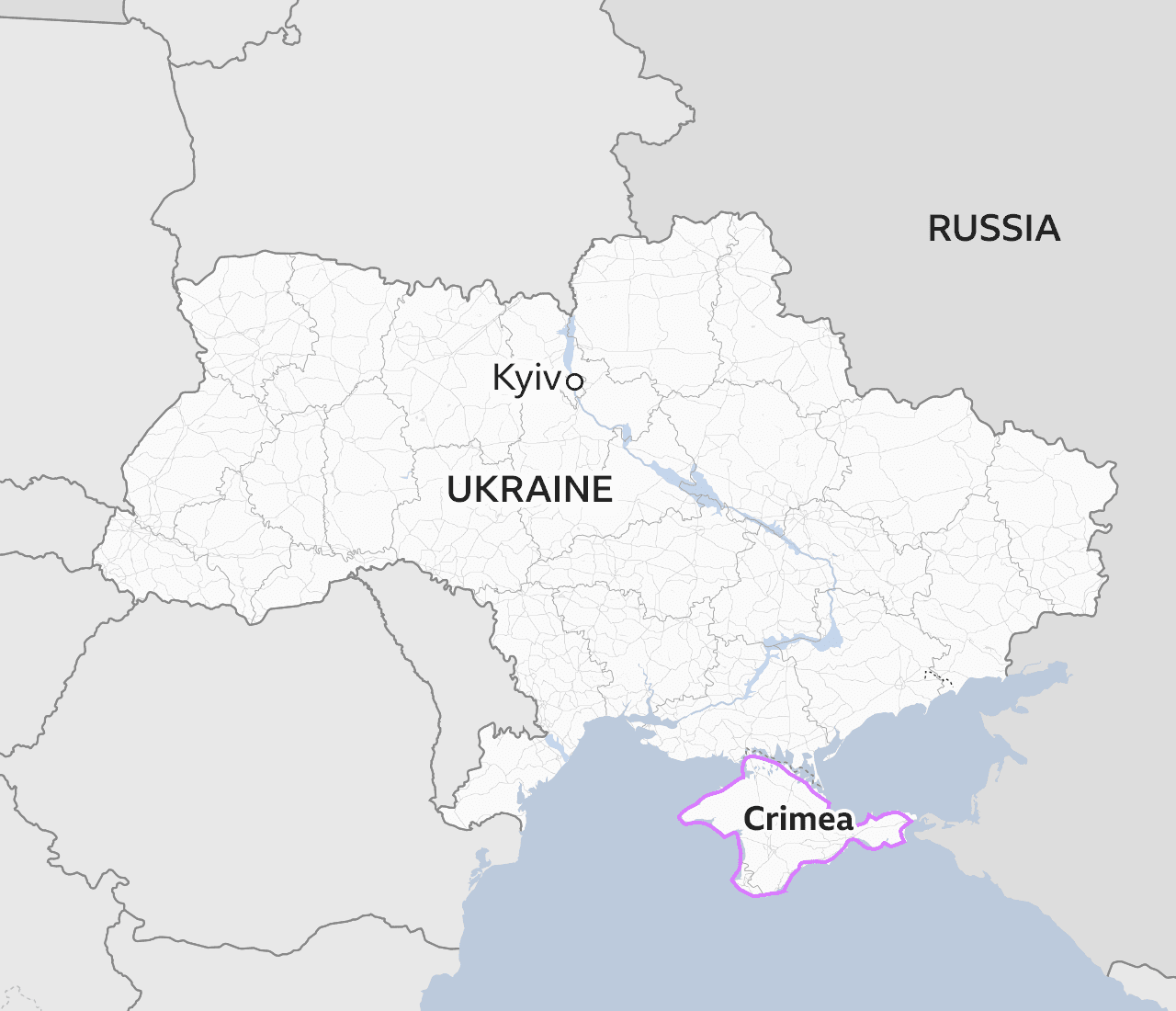 Image caption: President Putin sees Ukraine as historically part of Russia. In 2014, Russia invaded Crimea, in the south of Ukraine, and continues to occupy it.
 -
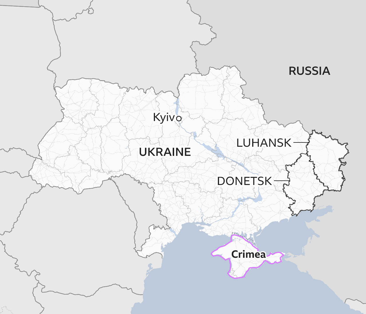 Image caption: Since 2014, Russian-backed separatists and Ukraine’s armed forces have been fighting a war in the eastern regions of Donetsk and Luhansk in which more than 14,000 people have died.
 -
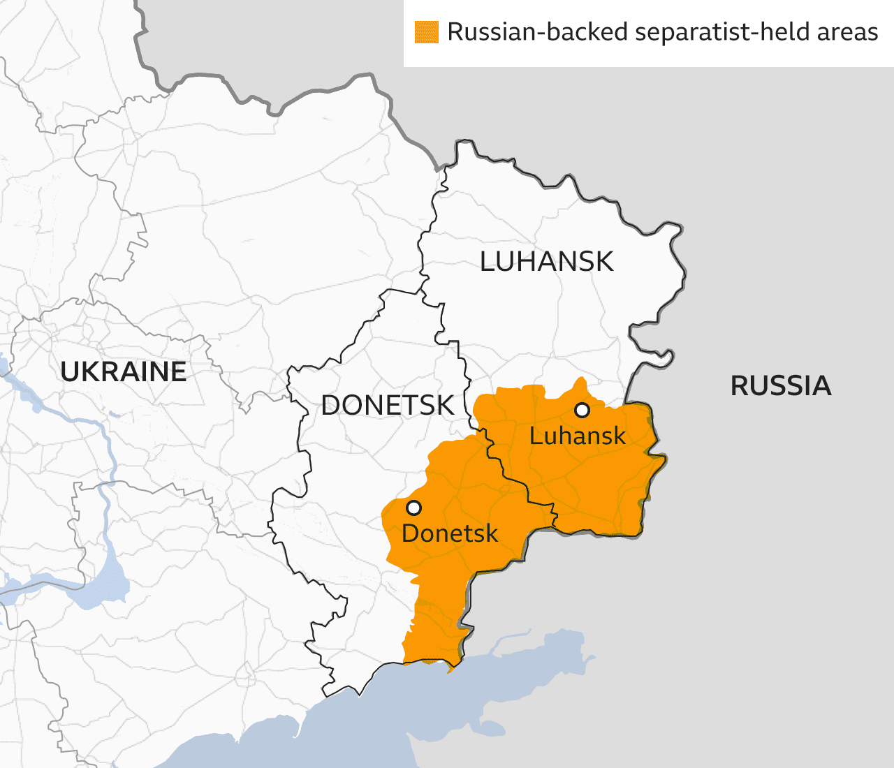 Image caption: President Putin has now recognised the two regions held by the Russian-backed separatists as independent states and ordered Russian troops there, tearing up a peace deal.
 -
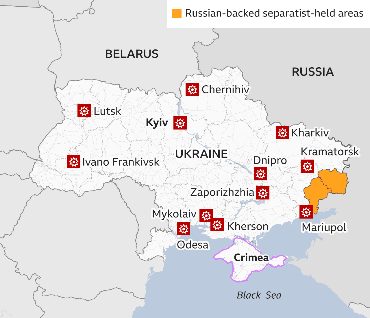 Image caption: On Thursday 24 February, President Putin authorised airstrikes across Ukraine and ordered his troops to advance into the country.
End of image gallery